
A recent ExploreGeorgia.org article promised: “Providence Canyon State Park offers a fascinating look at the nature that makes west Georgia unique, and winter is the perfect time to see it all. In the absence of hardwood foliage and vegetation, visitors experience a landscape like nowhere else in the state” I’ve wanted to visit Providence Canyon for some time and this was just the incentive I needed to make it happen.
Exploring Providence Canyon was the perfect way to spend a gorgeous winter day in Georgia. The sun was shining, the temperature hit a balmy 67⁰F, and the scenic views were stunning!
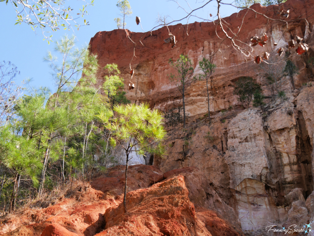
Providence Canyon is a Georgia State Park covering 1,108 acres and a series of 16 canyons. Overall, Providence Canyon is 300 feet wide and 150 feet deep. Interestingly, the canyon continues to grow because 3-5 feet of canyon wall is lost every year due to rainwater and erosion.
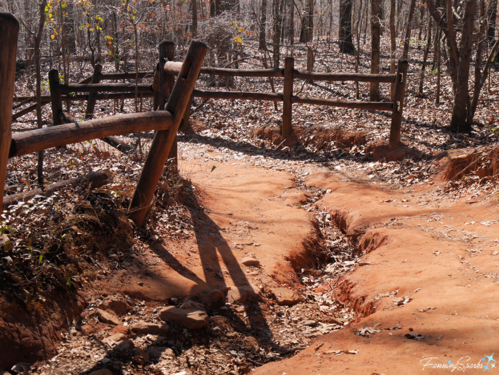
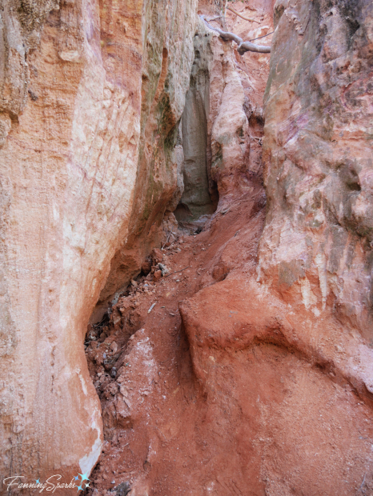
Visitors can hike down into the canyons to explore the canyon floor. One of the first things a hiker will notice is the washout and the gullies crossing the hiking trail down to the canyon floor. This soil erosion is a good indication of what’s to come.
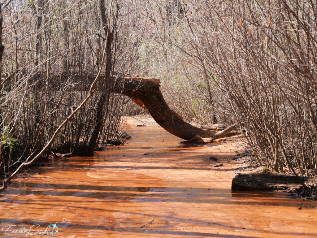
At the bottom of the canyon, much of the trail follows the sandy, wet bottom of Turner Creek. A variety of trees, including sweet gum, umbrella magnolia, tulip poplar, sycamore, maples and blackjack oaks, grow along the canyon floor.
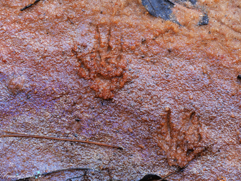
The canyon floors are peaceful and, except for the singing of birds, remarkably quiet. The sandy path was covered in the footprints of other visitors—both human and wildlife. White-tailed deer, red and grey foxes, raccoons, armadillos, birds, frogs and snakes are reported to live in the canyons. I believe the animal tracks, pictured below in the vibrantly-colored sand, were left by raccoons.
Wayfinding signs direct hikers to the nine canyons accessible from the trail. Signs also instruct visitors to stay off the canyon walls—no climbing is allowed.
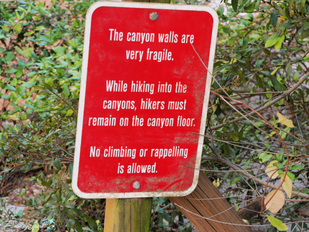
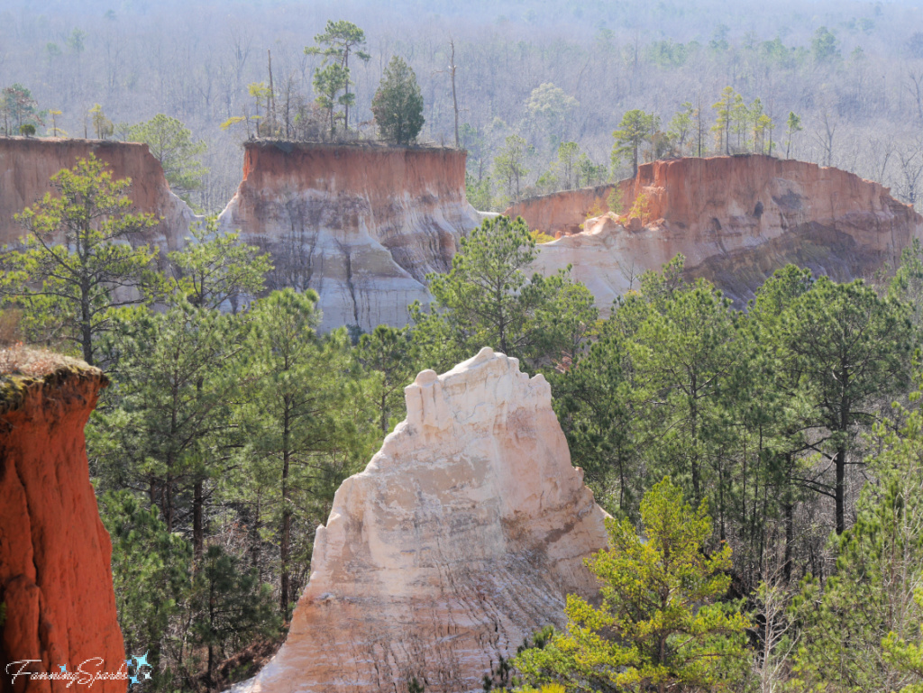
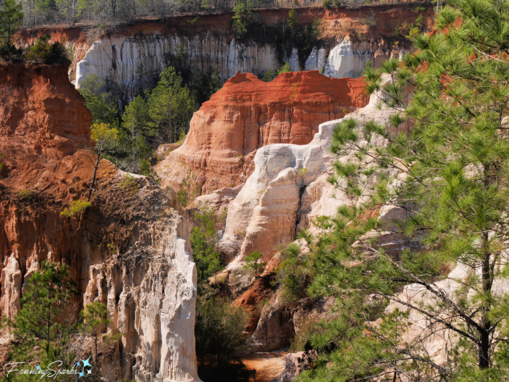
As soon as the canyon walls come into sight, it’s obvious why these warnings are necessary—all the narrow openings, rounded boulders and layered rock faces tempt visitors to explore further.
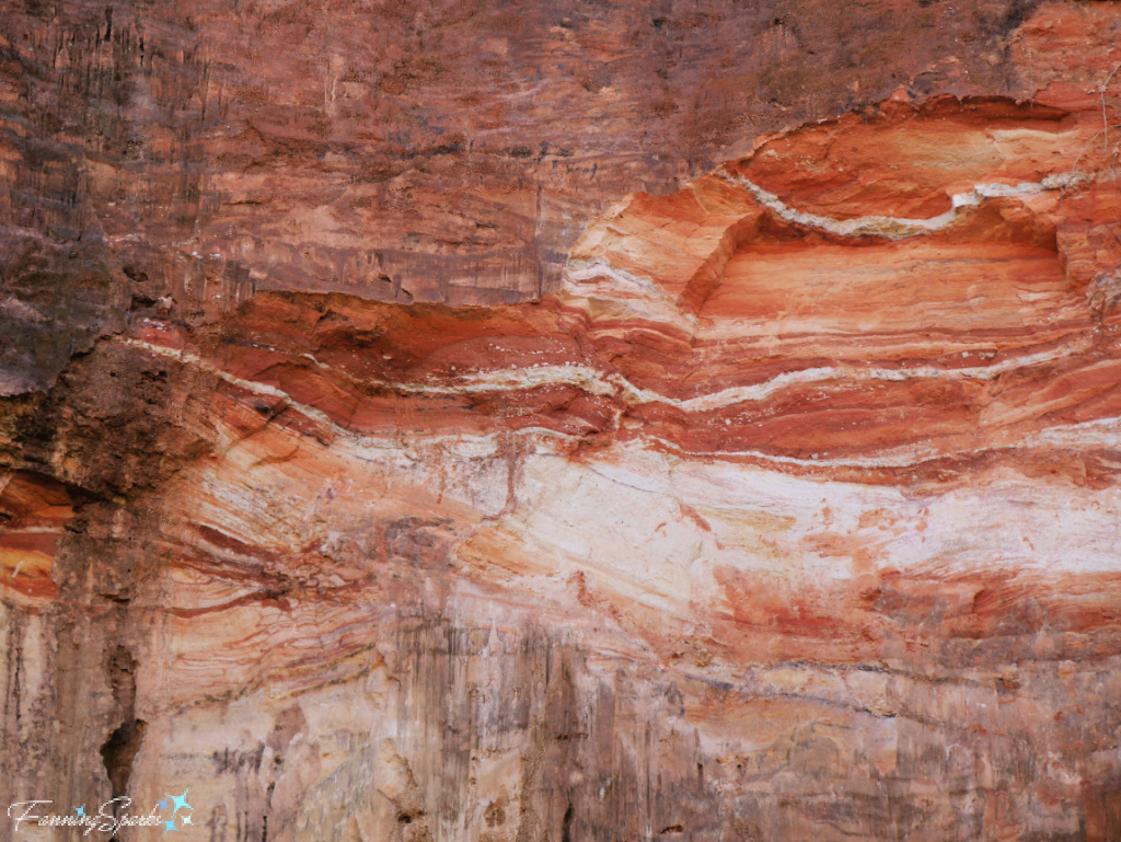
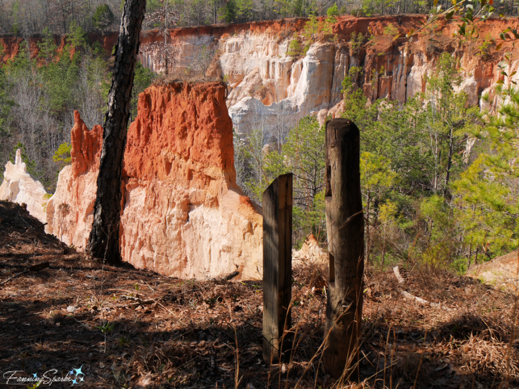
But it is enough to just look at the canyon walls. The Park’s brochure explains “Some 43 shades in soil can be seen, and the splendor of the colors – ranging from light orange, salmon, red and scarlet to white, purples and pink – is a sight worth seeing.” The various colors are attributed to different mineral deposits—oranges and reds from iron; purples and pinks from manganese, yellows and tans from limonite, and whites from kaolin. The remarkable forms, rainbow colors and striped patterns on the colorful sedimentary walls are strikingly beautiful.
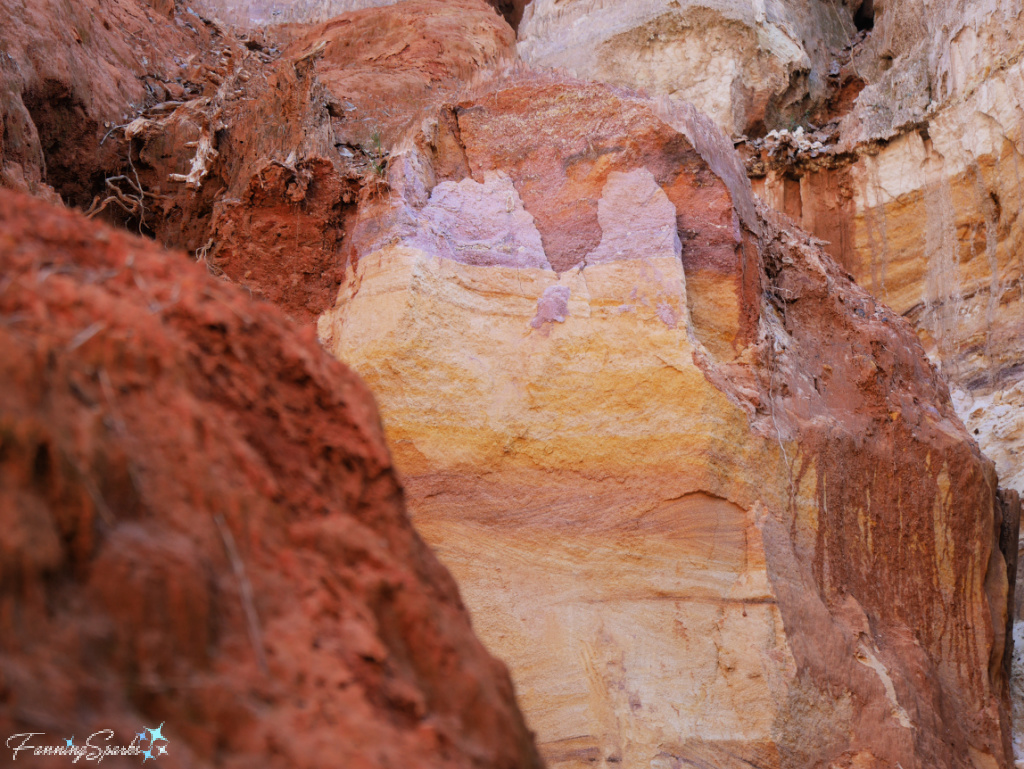
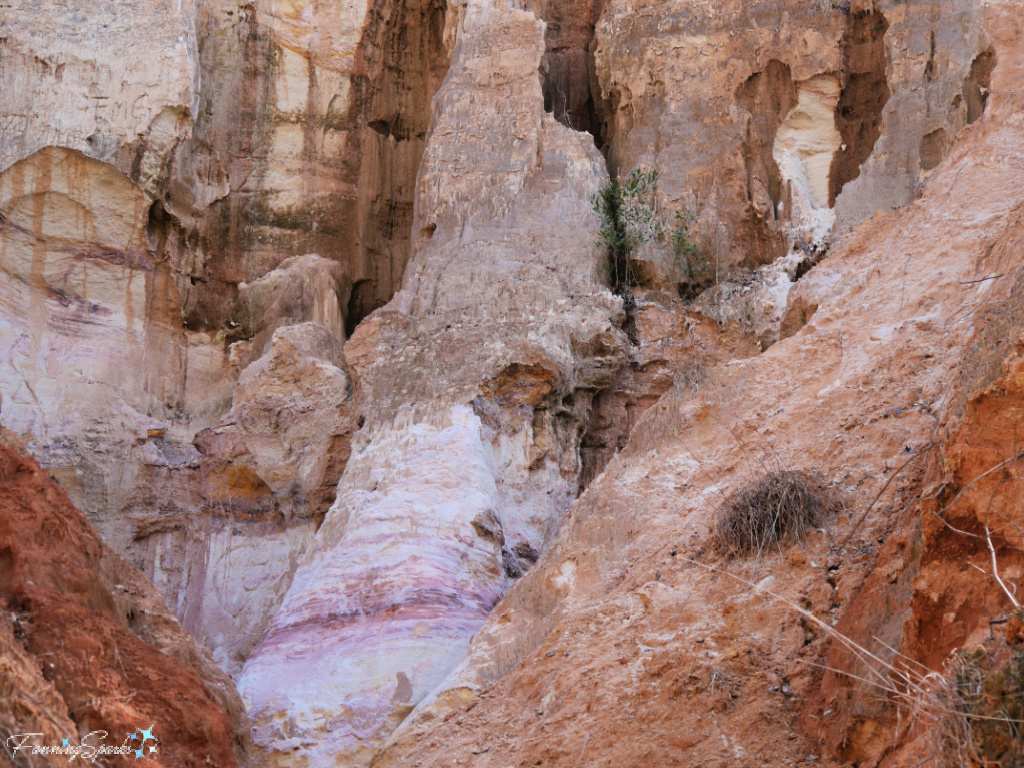
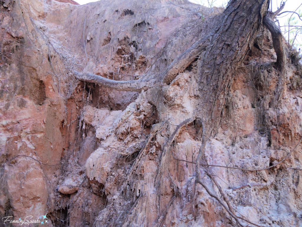
All along the canyon walls there is evidence of deterioration and washout.
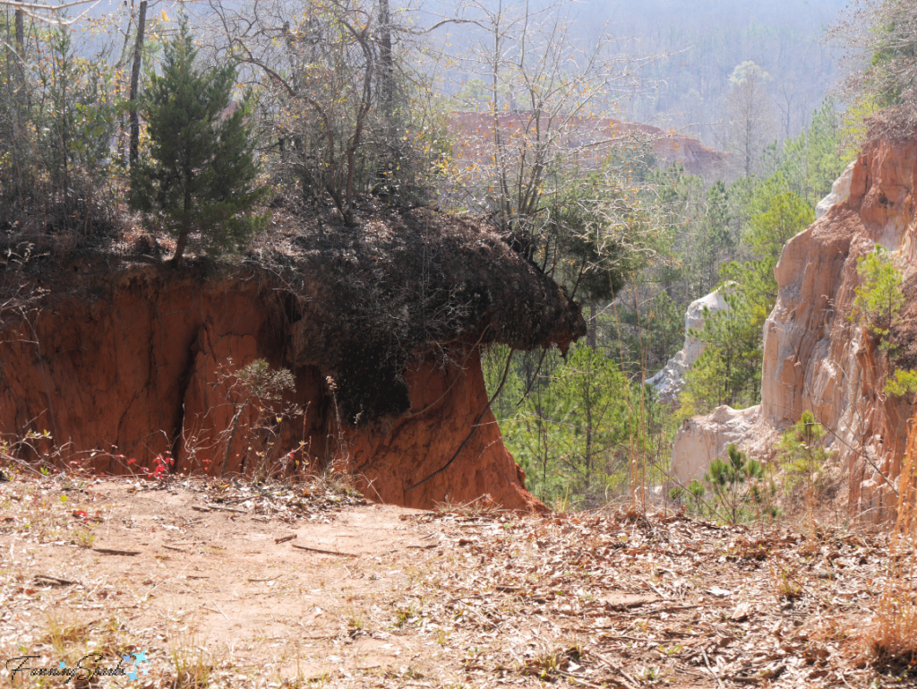
Looking up, there are areas where the trees grow up to the edge of the canyon rim.
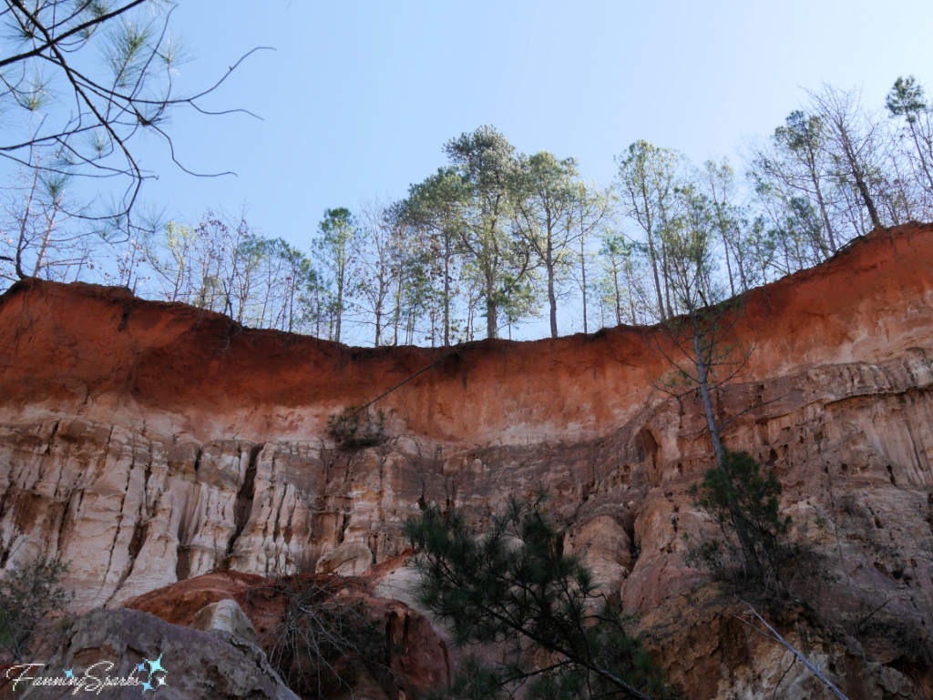
Some trees appear to be making a valiant effort to cling to the canyon walls…
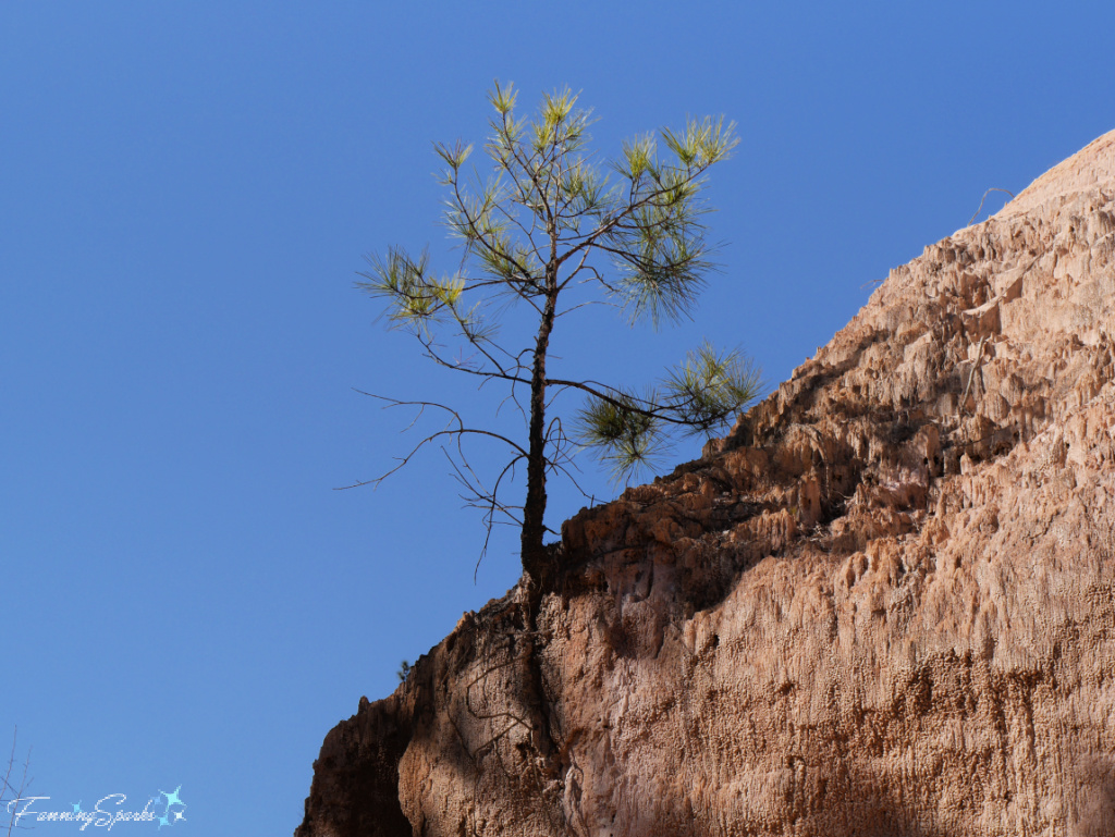
… but most appear to lose the battle for survival.
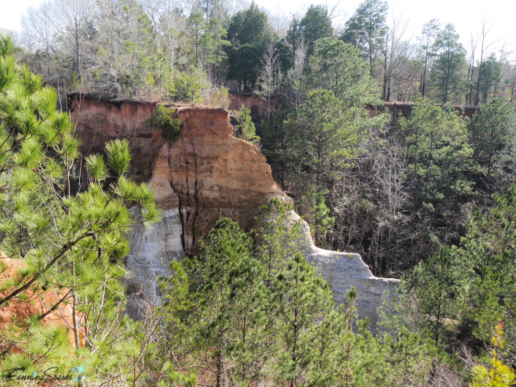
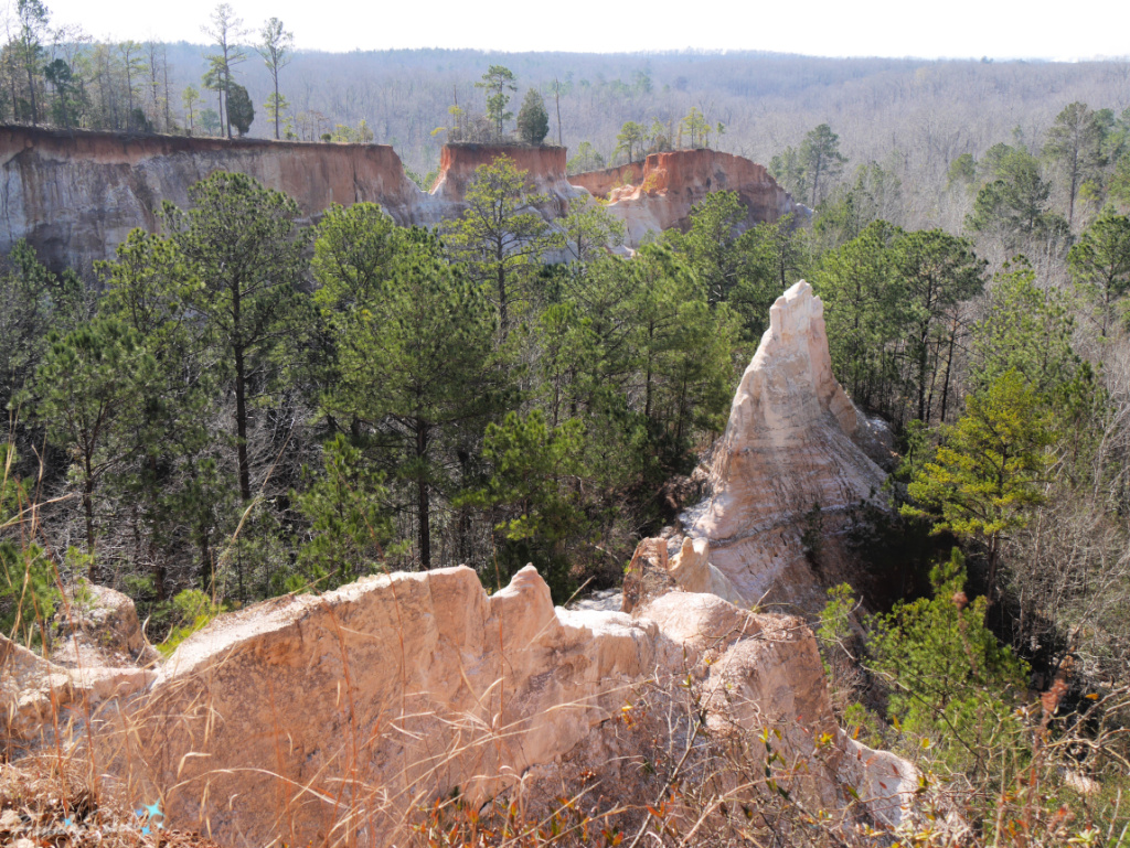
In addition to exploring the canyon floor, visitors can hike the Park’s two trails—the Canyon Loop Trail (white blaze) and the Backcountry Trail (red blaze). I chose the Canyon Loop Trail which circles 9 of the canyons and is 2.45 miles long. The trail climbs up out of the canyon, loops out around the canyon fingers and then follows the rim. The views from the canyon rim are spectacular.
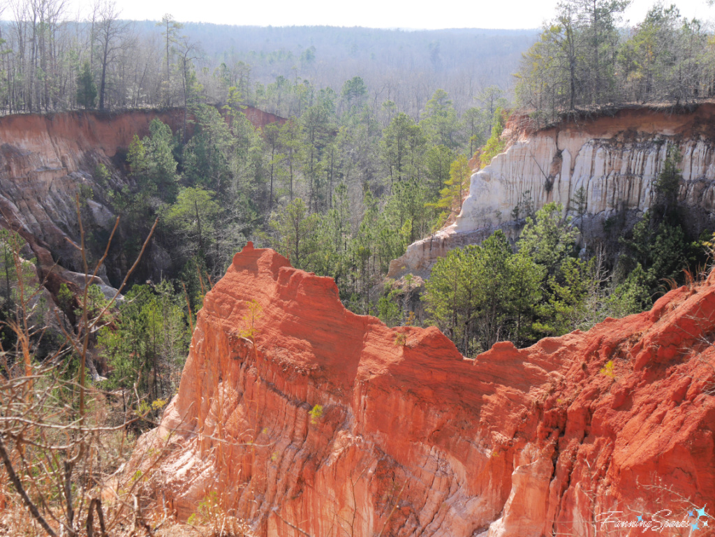
The geologic formations which form the canyon are obvious from this vantage point. Three major layers, originating from 59 to 80 million years ago, can be seen. The top layer, called the Clayton Formation, is comprised of reddish clay sand.
The middle layer, called the Providence Formation, is primarily yellow, purple, orange and white. The bottom layer, called the Ripley Formation, was once the ocean floor and is comprised of grayish clay.

A wooden fence traces the top edge of the canyon walls. Visitors are continually reminded of the danger and warned not to climb on the fences or over the fence line.
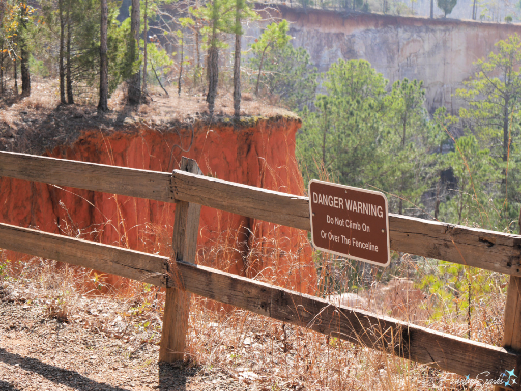
Upon closer inspection, the fence line itself is a very real indicator of the canyon’s continual erosion. There are numerous spots where an old stretch of fence has obviously been rerouted and replaced by a new section.
Check out the fence railing (entering and exiting from the left side of this photo) along the top of this precarious-looking cliff. I chose to bypass that section!
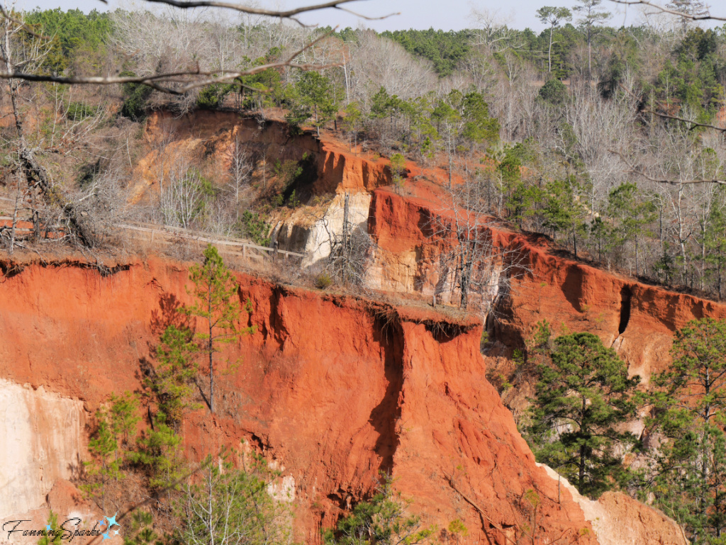
It’s obvious the State Park’s warning that “canyon edges may collapse” is serious business. In fact, back in 1994, a section of the Park Road that leads from the Park entrance to the Interpretative Center had to be rebuilt to safely avoid the damage of erosive forces.
Informational signs explain “The canyons grow in two ways; through surface water erosion and through undercutting and slumping by the force of underground water. The heads of the canyons and the walls can be quickly eroded by the force of water from heavy and even light rainfall washing away the surface. Dramatic changes come when water causes tons of earth to slump off the walls by undercutting.” Evidence of undercutting is clearly visible along sections of the canyon rim.
The forces of nature continually expand Providence Canyon but it hasn’t always been that way. Up until the early 1800’s, an untouched forest of dense pine and hardwoods covered the area. The land was relatively stable with a steeply sloped, undulating surface. Early settlers moved to the area in the 1820’s. They cleared the land and tilled the soil to begin cotton farming. At the time, it was common practice to plow a slope from top to bottom as opposed to following the contours of the land and plowing from side to side. Unfortunately, the lack of vegetation along with the top-to-bottom furrows severely altered how heavy rains affected the land. Surface water gushed down the slopes and gullies began to form in the sandy soils. In less than 25 years, the gullies were over five feet deep. Today, the canyon is over 150 feet deep and 300 feet wide. It’s a sobering reminder of the negative effects man’s actions can have on the natural world.
Despite the canyon’s origin, it’s impossible not to marvel at the beauty that is visible today. It’s also amazing that a visitor can explore the canyon floor and then an hour or two later look back down on that same spot from high above on the canyon rim. This photo taken from the canyon rim looks down onto the floor of Canyon 4.
More Info
See the ExploreGeorgia.org article, Providence Canyon: A Must-See in Winter, which caught my eye and convinced me to visit this month.
Check out the Providence Canyon State Park website to learn more about this great park located in southwest Georgia, USA. The Park is a popular destination especially since the pandemic struck. There were only a dozen or so other people when I visited on a weekday in early February 2022. However, a WRBL.com news article from early 2021 warns: “On the weekends the park is averaging between 400-500 visitors. Only 250 visitors are allowed to go onto the trails at a time. Due to the high volume of visitors on the weekend, the park routinely runs out of parking spaces for visitors.” I don’t know if this is still the case but it would be worth checking with the Park before making the trip.
For a detailed analysis of the erosion of unconsolidated sediments at Providence Canyon State Park, see the article Providence Canyon, Stewart County, Georgia – Evidence of Recent Rapid Erosion by Emmett L. Williams in the June 1995 issue of Creation Research Society Quarterly Vol. 32 No. 1.
You may also enjoy these FanningSparks’ posts:
. Solid as a Rock explores the geoheritage of Nova Scotia, Canada.
. We Dined on the Ocean Floor in which I share my visit to Burntcoat Head on the Bay of Fundy which boasts the world’s highest tides.
. First Light at Peggy’s Cove celebrates daybreak on the rugged coastline near the iconic lighthouse in Peggy’s Cove, Nova Scotia.
Today’s Takeaways
1. Make time to appreciate the beauty in your own backyard.
2. Consider visiting popular destinations in the off-season.
3. Experience nature with a leisurely walk.


4 Comments
@Marian – I’ll have to check out Drumheller… sounds intriguing. Peg
What a beautiful find! As always great photo story.
Reminds me of Drumheller in the Badlands of Alberta
@Gary – Don’t forget your camera when you go… LOL. Peg
Great pics and story. As a newcomer to GA, I never knew this place existed!