
Visiting wild and remote Sable Island was a once-in-a-lifetime experience! This small island, located off the coast of Nova Scotia Canada, is simply fascinating. I recently had the rare opportunity to visit Sable Island and would like to share this interesting adventure in a two-part blog post. In today’s post, I’ll set the stage with 6 fascinating facts about Sable Island. Sable’s wildlife, including its beloved wild horses, will be the focus of my next blog post (UPDATE: see Wild and Free on Sable Island).
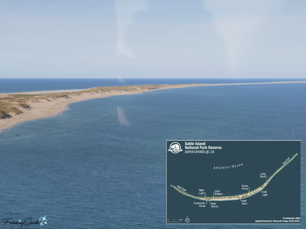
1. Sable Island is the Smile of the Atlantic Sable Island is a long, thin crescent shape—approximately 42 km (26 miles) long and 1.3 km (.8 miles) across at its widest point. When viewed from above it’s obvious how it earned the nickname The Smile of the Atlantic.
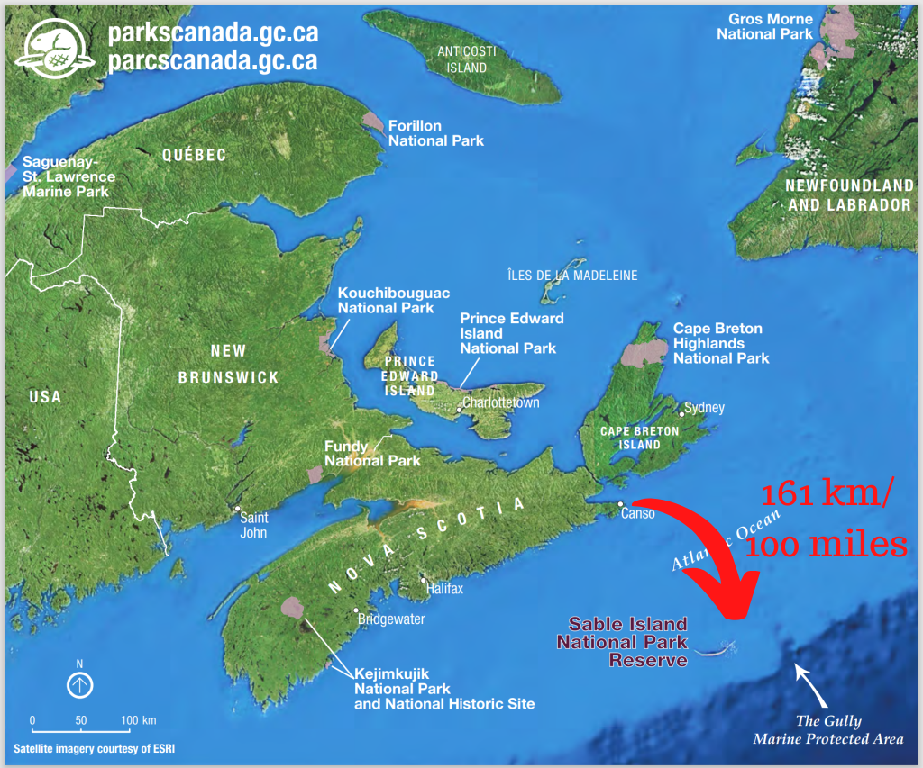
2. Sable Island is Isolated and Remote Sable Island can be found 161 km (100 miles) offshore from Canso, Nova Scotia. It is located to the southeast, near the edge of the Continental Shelf, close to one of the world’s richest fishing grounds. Sable is also near a major shipping route between North America and Europe.
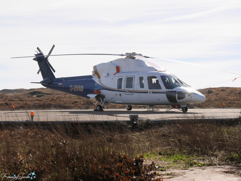
Sable Island is only accessible by air charter or private vessel anchored offshore. Both methods of transportation require ideal conditions to operate. The weather on Sable Island is often less than ideal resulting in frequent delays and cancellations. They’re so common, in fact, that the standard practice is to automatically reserve the day following a scheduled travel date as the alternate date. Our recent trip was a case in point.
We were scheduled to fly to Sable Island on a small, fixed wing aircraft on a Saturday. Sunday was our backup travel day. Due to the impacts of Hurricane Fiona there was some question about a safe runway area for landing on the Island’s beach. Thus, our tour company, Kattuk Expeditions, made backup plans to fly by helicopter. Conditions were assessed on Friday and the decision was made late in the day to travel on Saturday by helicopter. The flight, which took about 1.5 hours, was smooth and easy.
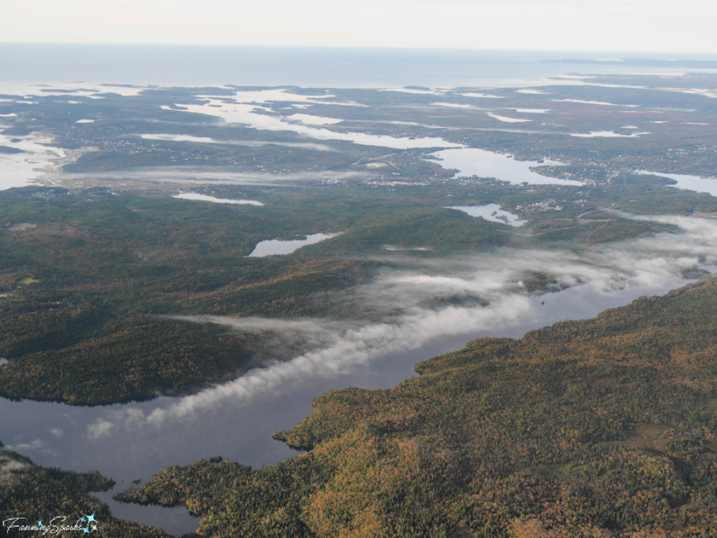
One of the challenges in travelling to Sable Island is dense fog. Sable is surrounded by three major ocean currents including the Gulf Stream, the Labrador Current and the Belle Isle Current. In the summer months the warm air of the Gulf Stream hits the cool air of the Labrador Current resulting in heavy fog. July is the foggiest month with an average of 22 days of fog.
Fog was visible over the lakes as we flew over Nova Scotia but the skies were clear over Sable Island.
We were fortunate to have beautiful weather for our trip—clear skies, lovely sunshine, warm temperature and very little wind. There was a great view of Sable Island as we approached.
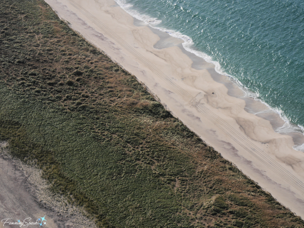
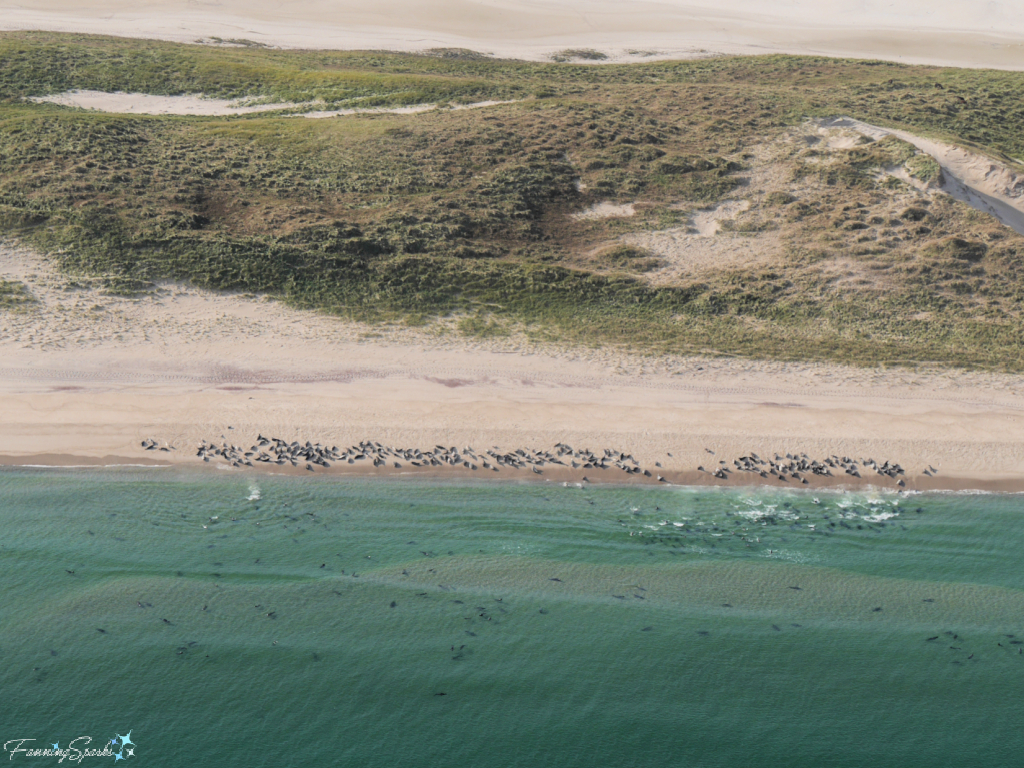
We were able to get our first glimpse of Sable’s extensive seal population…
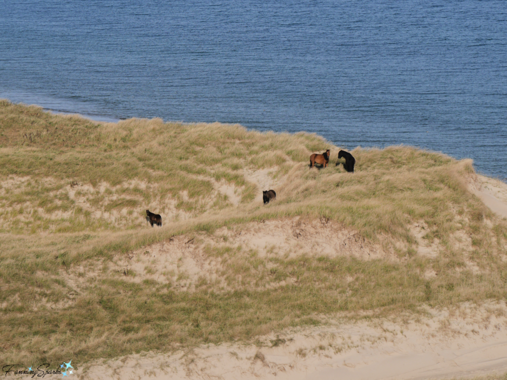
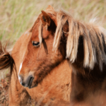
… and its famous wild horses.
3. Access to Sable Island is Carefully Managed The impact of visitors on the Sable Island National Park Reserve is carefully managed by Parks Canada. Visitors are only allowed during 5 months of the year—from the beginning of June to the end of October. All visitors (or their tour company) must submit a Visitor Request Form to Visit Sable Island in advance of their trip. Parks Canada reviews visitor requests and trip dates on a first-come, first-served basis. Only a limited number of visitors are permitted each day. There is a long waitlist of people who wish to travel to Sable Island.
These measures are in place to protect Sable Island’s frail ecology. This was a major concern when Sable Island was first established as a national park reserve in 2013. At the time, according to a 2014 CBC news article, conservationists voiced concerns that “we could love Sable Island to death…[with] too many visitors trampling over the island”.
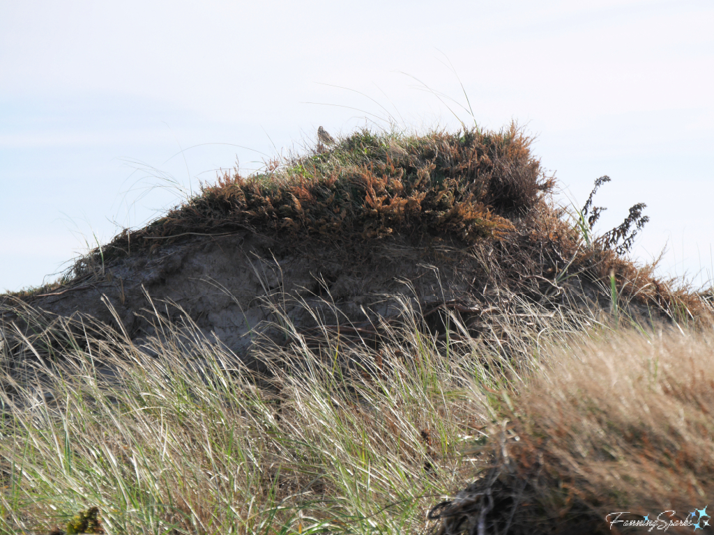
All visitors to Sable Island participate in an orientation to familiarize them with Sable and to educate them on safe and sustainable practices. Guidance is provided on watching where you step, keeping the wildlife wild and respecting research projects. It’s important, for instance, to stay off the steep dune slopes and not to disturb the vegetation which is holding the dunes together.
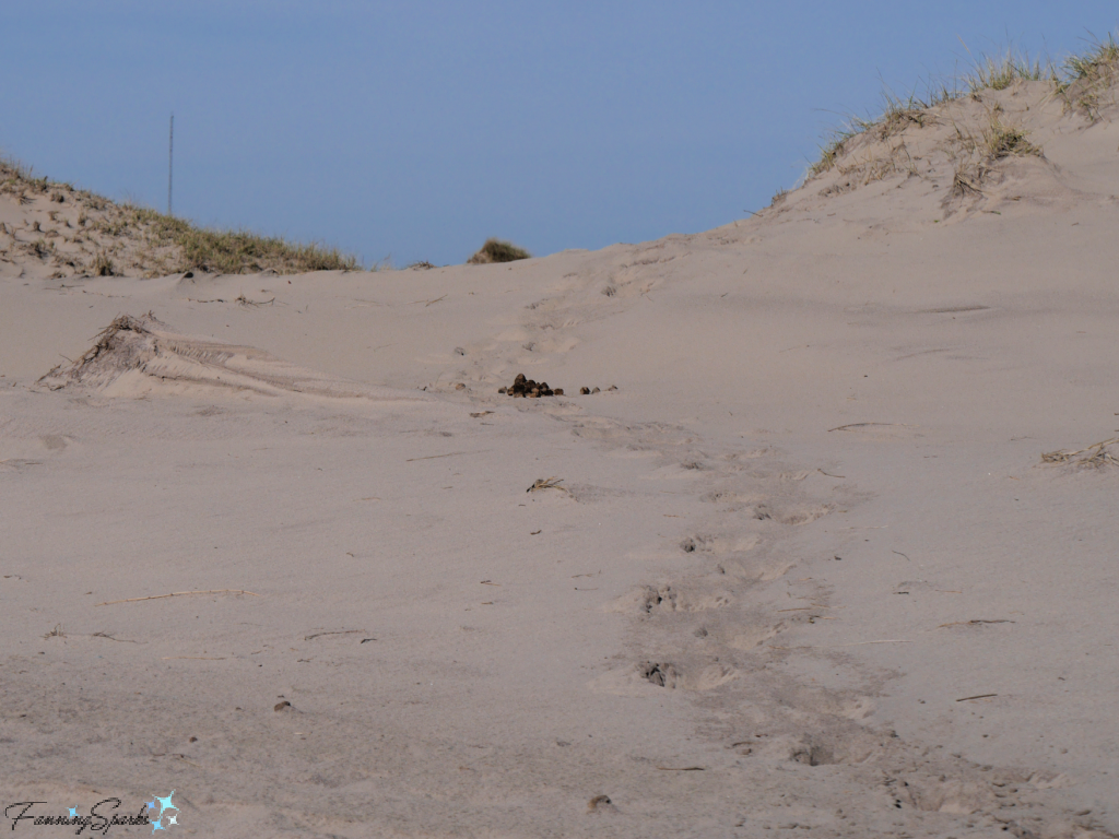
Visitors are instructed to “follow existing horse paths as much as possible” or to walk on “the hard-packed sand of the beaches [which] is the easiest and best place to travel.” Shown below are horse footprints and, yes, horse dung in the sand.
Parks Canada has also put biosecurity measures “in place to protect Sable Island and reduce the risk of introduction of any organic material including plants, seeds, soil and diseases.” This means clothing and footwear must be inspected and cleaned of obvious seeds or insects (e.g. burdock, insects, spiders, ticks); all footwear must be disinfected; and equipment or footwear exposed to horses off the Island is not permitted.
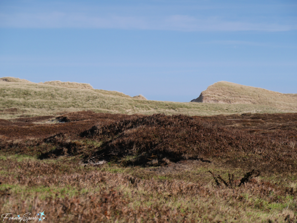
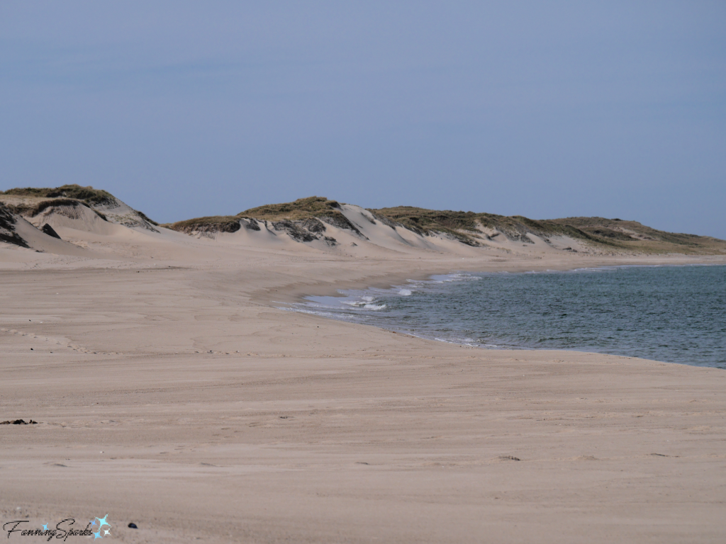
4. Sable Island is a Shifting Sandbar The name, Sable Island, comes from the French “île de Sable” which literally means “island of sand”. Sable’s landscape is dominated by shifting sand dunes surrounded by expansive, white sand beaches. This photo was taken along Sable’s North Beach.
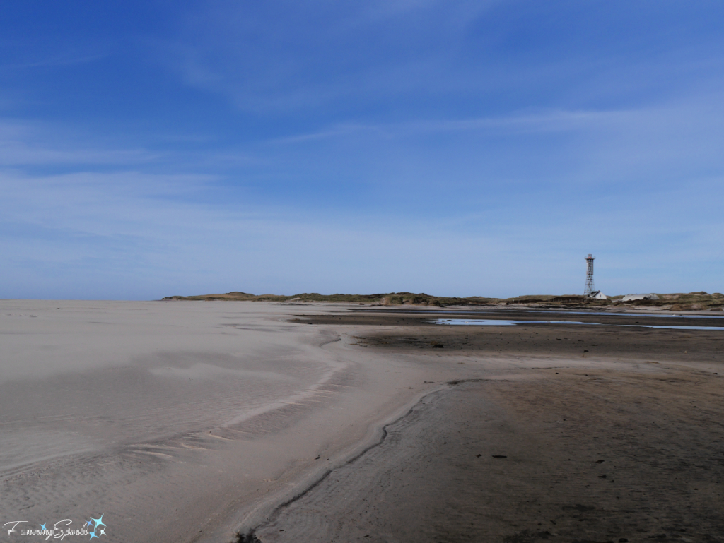
The below photo, showing the West Light communication tower in the distance, was taken along Sable’s South Beach.
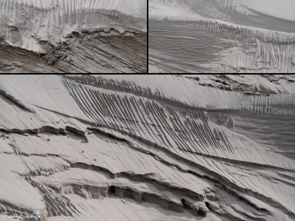
“Surrounded by the waters of the Northwest Atlantic Ocean, the Island is exposed to winds, storms, waves and swell coming from every direction.” reports the Sable Island Institute website. The sands are constantly shifting.
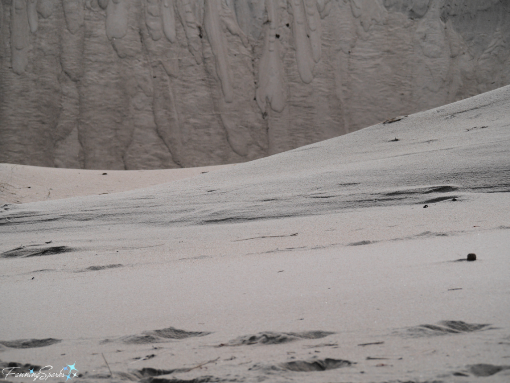
The patterns of windswept sands are surprisingly beautiful.
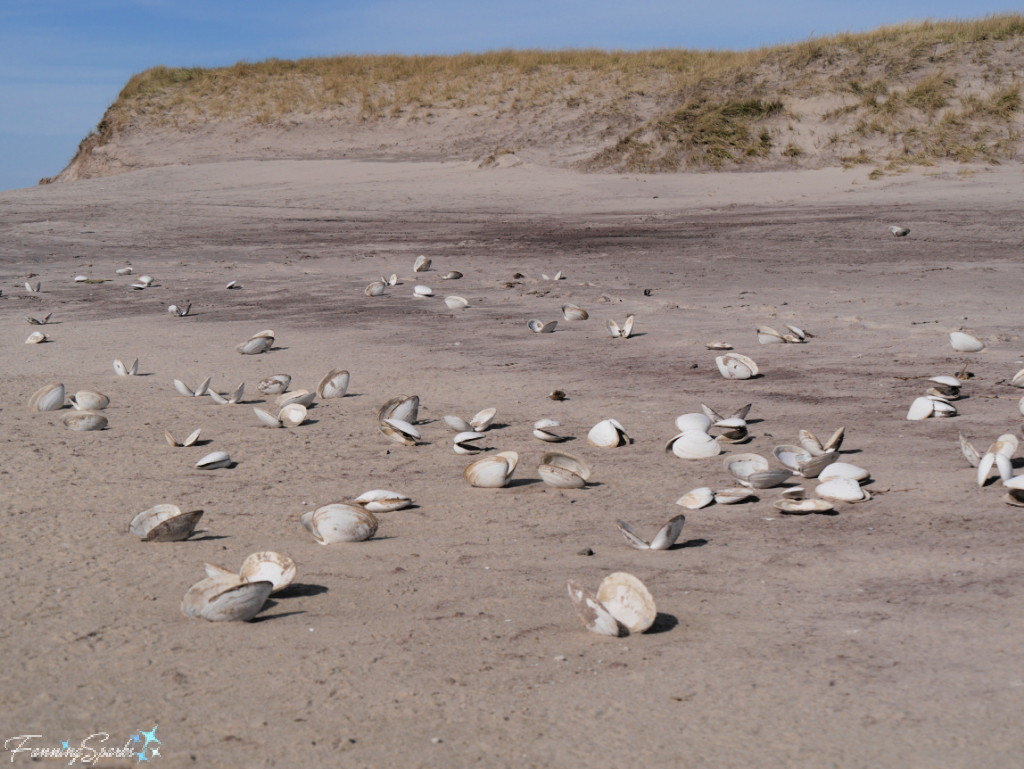
Storms, such as Hurricane Fiona which recently struck the area with some of the highest winds on record, cause noticeable changes. Jason Surette, Operations Manager at Sable Island National Parks Reserve, shared this update after Fiona, “The Island’s infrastructure has sustained some external damage, like lost siding and some roofing damage. Clean-up and urgent repairs began when it was safe to be outside. The infrastructure did not sustain major damage, but the scale is large.” As the first group to visit Sable Island after Hurricane Fiona, we heard the update from Jason directly and saw evidence of the infrastructure damage.

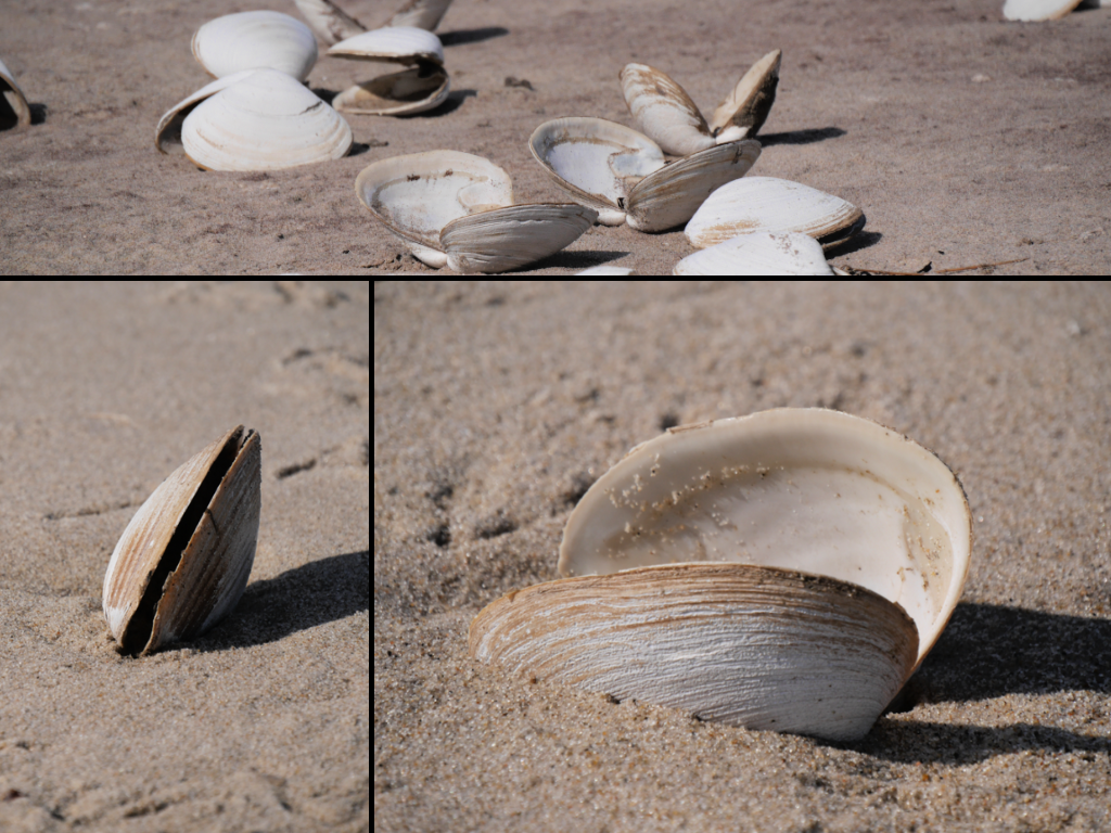
We also witnessed some unusual impacts on the natural elements of the Island. For instance, hundreds of Atlantic Surf Clams (Spisula solidissima) were thrown onto the beach providing the local gulls with an all-you-can-eat buffet. These clams are amazingly large—reaching up to 20 cm (7.9 in) or more in length. Here’s how the empty shells looked on South Beach.
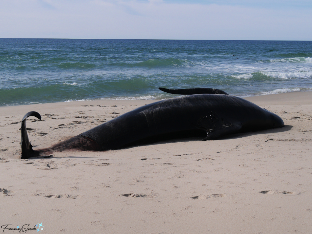
Sadly, we also saw a dead pilot whale which had washed on shore.
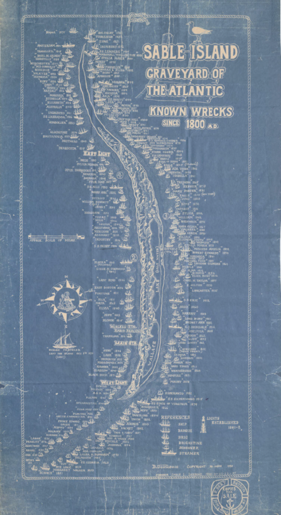
5. Sable Island was The Graveyard of the Atlantic There was a time when a storm as fierce as Hurricane Fiona would have resulted in multiple shipwrecks on Sable Island. I learned about these shipwrecks from an excellent exhibit at the Maritime Museum of the Atlantic in Halifax, Nova Scotia. Sable Island is called out as a Shipwreck Hotspot for especially high concentrations of shipwrecks. Between 1583 and 1947, over 350 shipwrecks were reported on Sable Island, earning it the title The Graveyard of the Atlantic. This 1938 map from the Nova Scotia Archives Map Collection shows known wrecks since 1800 (see the More Info section below for a link to the original zoomable image).
The museum’s exhibit goes on to answer the question “Why so Many Wrecks?” explaining that “hundreds of vessels sailed past each year” as they traveled the Transatlantic shipping route or headed to the rich fishing grounds. When these sailing vessels encountered the dense fog, tricky ocean currents and frequent storms that were typical of Sable Island, they often ended up on the sandy shoals that surrounded the island. “Storms were extremely treacherous for sailing ships. Vessels were simply blown onto Sable.”
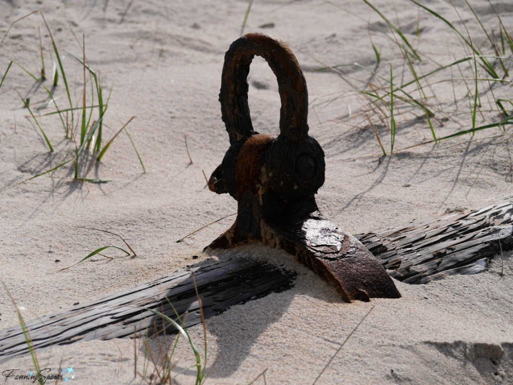
The wrecks were usually crushed or buried by sand and very little evidence is visible today. We did, however, see the remains of a wooden pole and metal ring which are believed to be from the mast of a wrecked ship.
“Public concern about the fate of shipwreck victims on Sable Island led to the first lifesaving station in 1801. This ‘Humane Establishment’ was active on the island until 1958. Many shipwreck victims owed their lives to the skill and courage of the lifesaving crew. … They were remarkably successful at saving lives.”
Thankfully, “After World War II, radar and other advanced navigational equipment became widely used on commercial vessels. Sable ceased to be a major threat to shipping. … The Humane Establishment ended in 1958, after 11 years without a shipwreck.”
6. Scientific Research is Conducted on Sable Island Ironically, many of the factors that earned Sable Island it’s title as the Graveyard of the Atlantic (i.e. its isolation, unique location and weather/climate challenges) have led to Sable Island’s current role in scientific research. It started with weather research in the 1960s and expanded to a range of ecological and wildlife studies.
As noted on the Sable Island Institute website, “Sable Island [is] a key site for exploring questions of global importance. Here, scientists study weather patterns and currents that spread pollution along the Eastern Seaboard, track migrant birds waylaid by storms, and observe thriving communities of isolated plants and animals.”
Visitors to Sable may see evidence of these research projects. For instance, we saw temporary fences that are part of the Fences in the Sand study. As explained by Parks Canada, “This exclosure study by Parks Canada and the Sable Island Institute will help us better understand the role of horses on the ecosystems of Sable Island National Park Reserve.
Temporary fences will create exclosures to keep horses from walking through or grazing in nine small areas on the island. Scientists will measure and compare a number of key ecological attributes inside the exclosures and outside in control sites (similar areas but without fences). The goal of the study is to understand direct and/or indirect influences of horses on 1. dune processes, 2. ecological integrity of freshwater ponds…, [and] 3. rare species and their habitats.”

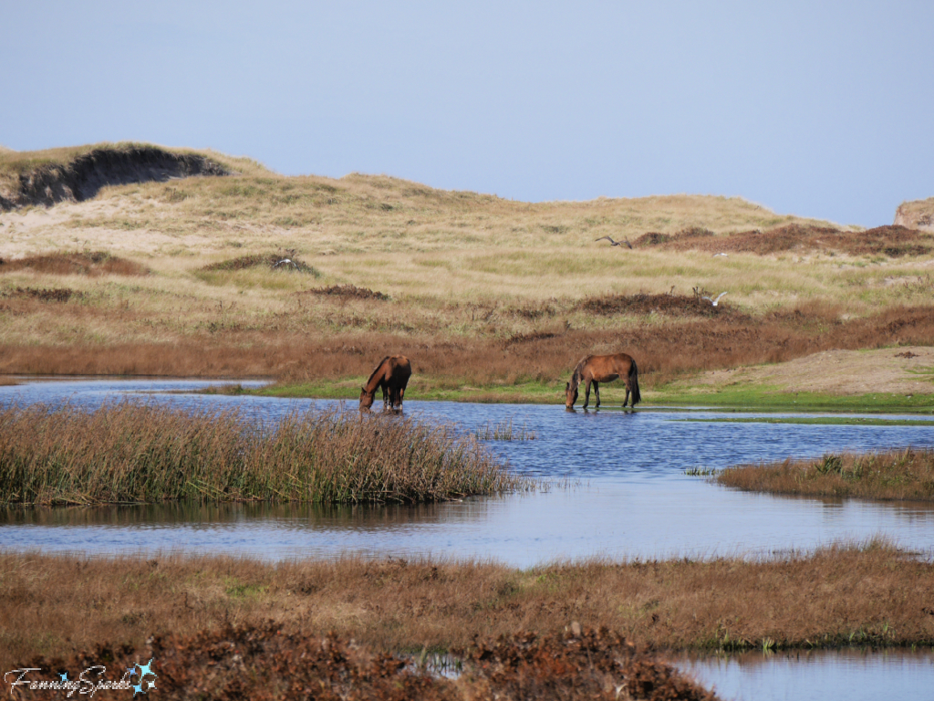
There are about 500 wild horses on Sable Island. These beloved animals are one of Sable Island’s main attractions. We saw several of these beautiful creatures during our visit. I’ll share photos of Sable Island’s wildlife in my next post (UPDATE: see Wild and Free on Sable Island). In the meantime, here’s a sneak preview.
More Info
Our trip to Sable Island was organized by, Kattuk Expeditions, a Parks Canada licensed tour company. As stated on their website, “Kattuk Expeditions is a happy group of outdoor professionals who take pride and joy in showing others the best in nature Eastern Canada has to offer.” See the Kattuk Expeditions website or Facebook page for more information. Special thanks to Fred and Devon for an incredible adventure.
The Sable Island National Park Reserve is managed by Parks Canada. See their website for more information.
As noted on their website, “by working in collaboration with respected organizations that share our values, Parks Canada is able to better deliver its promise to Canadians by continuing to be a world leader in the protection and presentation of Canada’s natural and cultural heritage.” The Sable Island Institute is one of these collaborative partners.
“The Sable Island Institute, a registered not-for-profit, is a multidisciplinary organization that will conduct and support Sable Island programs ranging from biodiversity surveys to public outreach initiatives. … The partnership will focus on the development and implementation of a beach monitoring program on Sable Island National Park Reserve, outreach education initiatives on the mainland, and enhanced visitor experience opportunities in the park.” See the Sable Island Institute website for more information.
The Canadian Broadcasting Corporation (CBC) News article, Sable Island: An Uncertain Future as a National Park mentioned in this blog post, can be found here.
The 1938 map, Sable Island Graveyard of the Atlantic Known Wrecks since 1800 AD included in this blog post, can be found in the Nova Scotia Archives Map Collection here. Note this image is zoomable for a closer look.
More information about The Maritime Museum of the Atlantic can be found on their website. Information about Sable Island – Shipwrecks and Lifesaving can also be found there.
Today’s Takeaways
1. Sable Island, located off the coast of Nova Scotia Canada, is wild and remote.
2. “Sable Island National Park Reserve is a place to be awed by the power of nature.” Parks Canada
3. Sable Island is “a key site for exploring questions of global importance“. Sable Island Institute


2 Comments
@Marian, Thanks for sharing this incredible experience! Wild horse photos coming up. Peg
Wonderfully written!
Great photos too. I am anxiously awaiting next week’s post